Wisconsin Ecological Units - Land Type Associations

Mon, Jan 18, 2021 47-minute read

These maps shows Wisconsin divided into about 290 ecological units called “Land Type Associations,” which obtained from the Wisconsin DNR. Mapping files and further documentation are available here.

Click here to download a detailed labeled version from Dropbox. Designed to be hung as a poster, it measures 42’x45’ and has a file size of 16.9MB. Keep scrolling to view an interactive version.

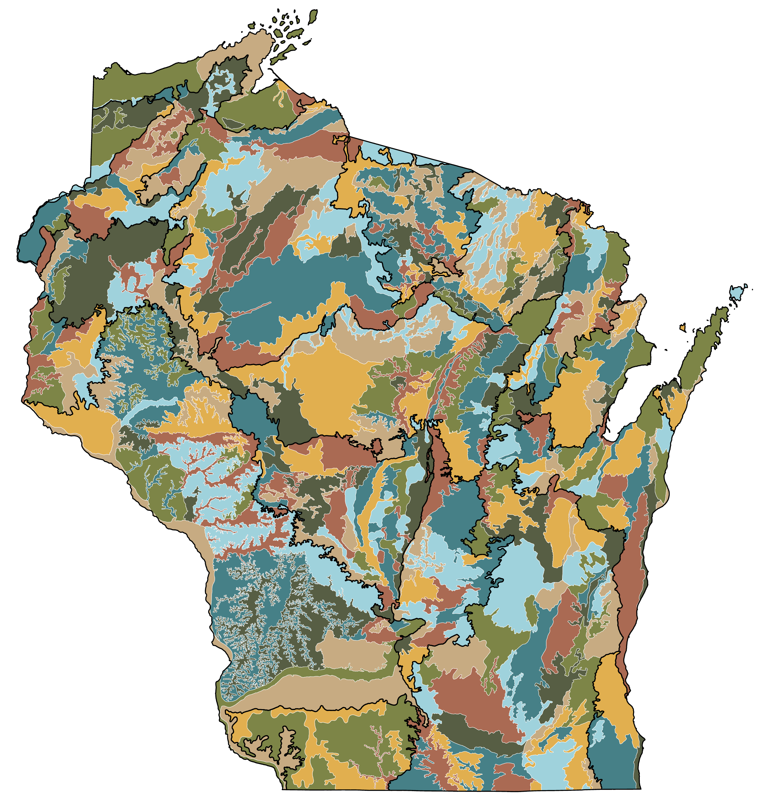
Click on the map to view details about geography, soil type, and habitat codes.

Per the DNR’s webpage:

Land Type Associations (LTAs) of Wisconsin represent a further definition of the National Hierarchical Framework of Ecological Units (NHFEU). The NHFEU is an ecological classification system that divides landscapes into ecologically significant regions at multiple scales. Ecological types are classified and units are mapped based on the associations of biotic and environmental factors which include climate, physiography, water, soils, air, hydrology, and potential natural communities.

Agencies that participated on the Wisconsin LTA Project Team include the Wisconsin Department of Natural Resources, the Natural Resources Conservation Service, the USDA Forest Service (State and Private Forestry and National Forests), the Wisconsin County Forest Association, the University of Wisconsin (at Madison and Stevens Point), Menominee Tribal Enterprise, and the Wisconsin Geological and Natural History Survey.

The palette used in this map is a variation of the colors used in the National Park Service poster for the Everglades N.P.S. as generated by Katie Jolly’s excellent R package {nationalparkscolors}.